An ALTA/NSPS land title survey is a specialized survey that meets the specific needs peculiar to title insurance purposes, to enable title insurance companies to insure title to land without exceptions as to survey matters. Often prepared for commercial properties, the ALTA/NSPS survey is the most comprehensive type of survey. It covers all aspects of the boundary survey and improvement location, and identification of any additional evidence of possession or use which could be adverse to the interests of the purchaser. Also, they show features such as utilities, flood zones, land area, building square footage, easements and building lines, parking spaces, signs, lights and more. We perform the survey to the current “2021 Minimum Standard Detail Requirements for ALTA/NSPS Land Title Surveys”
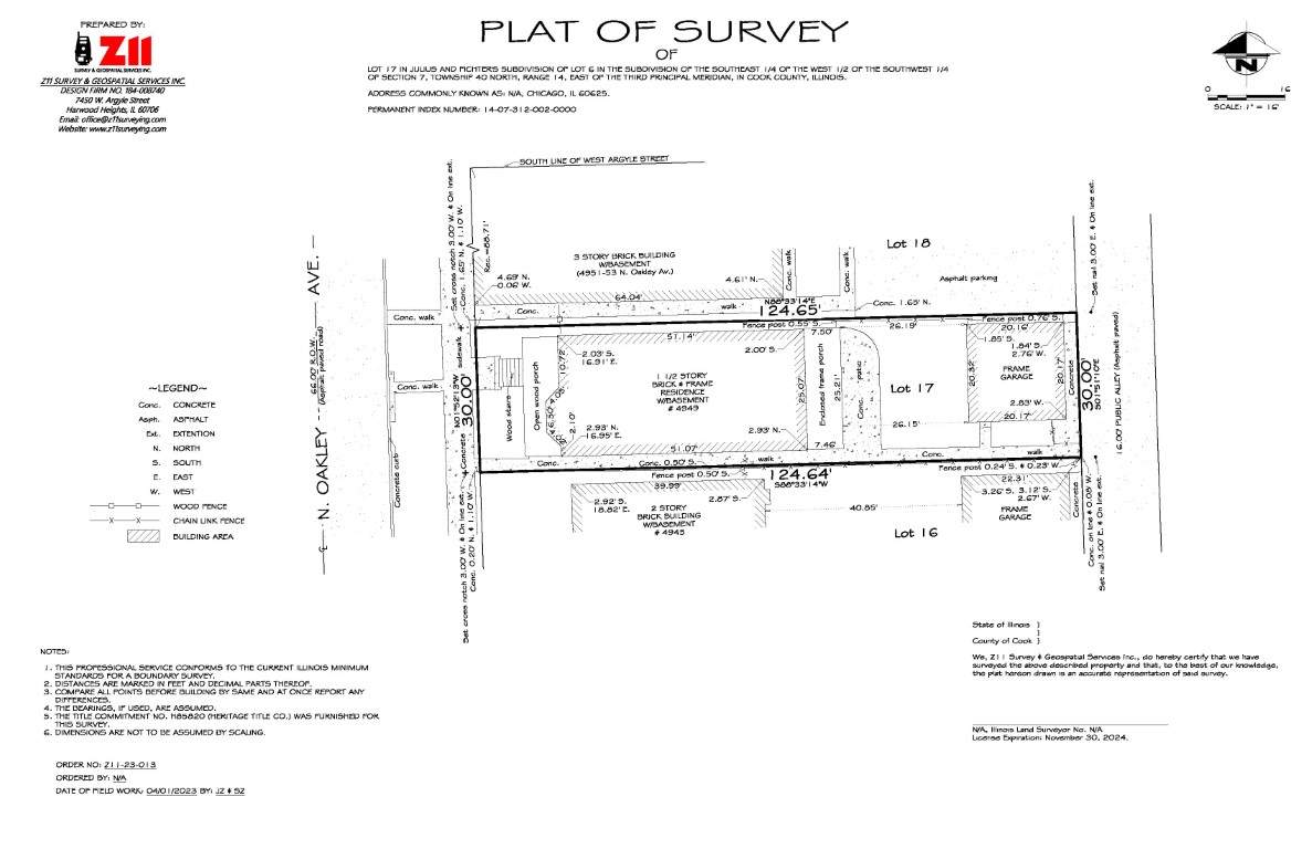
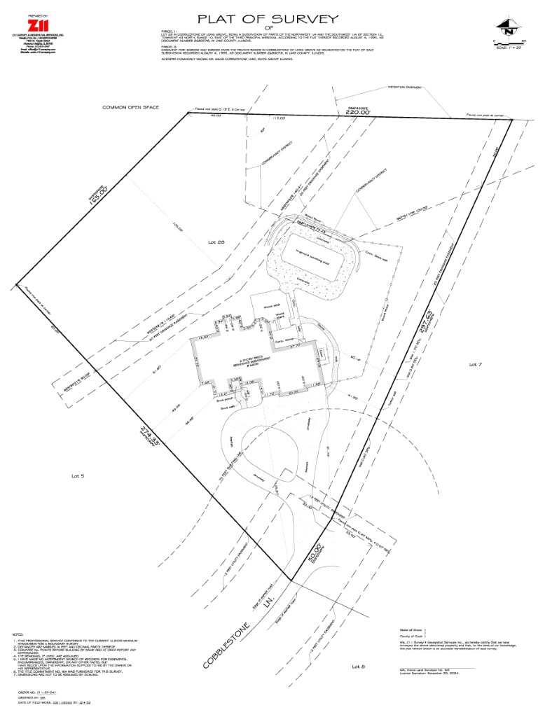
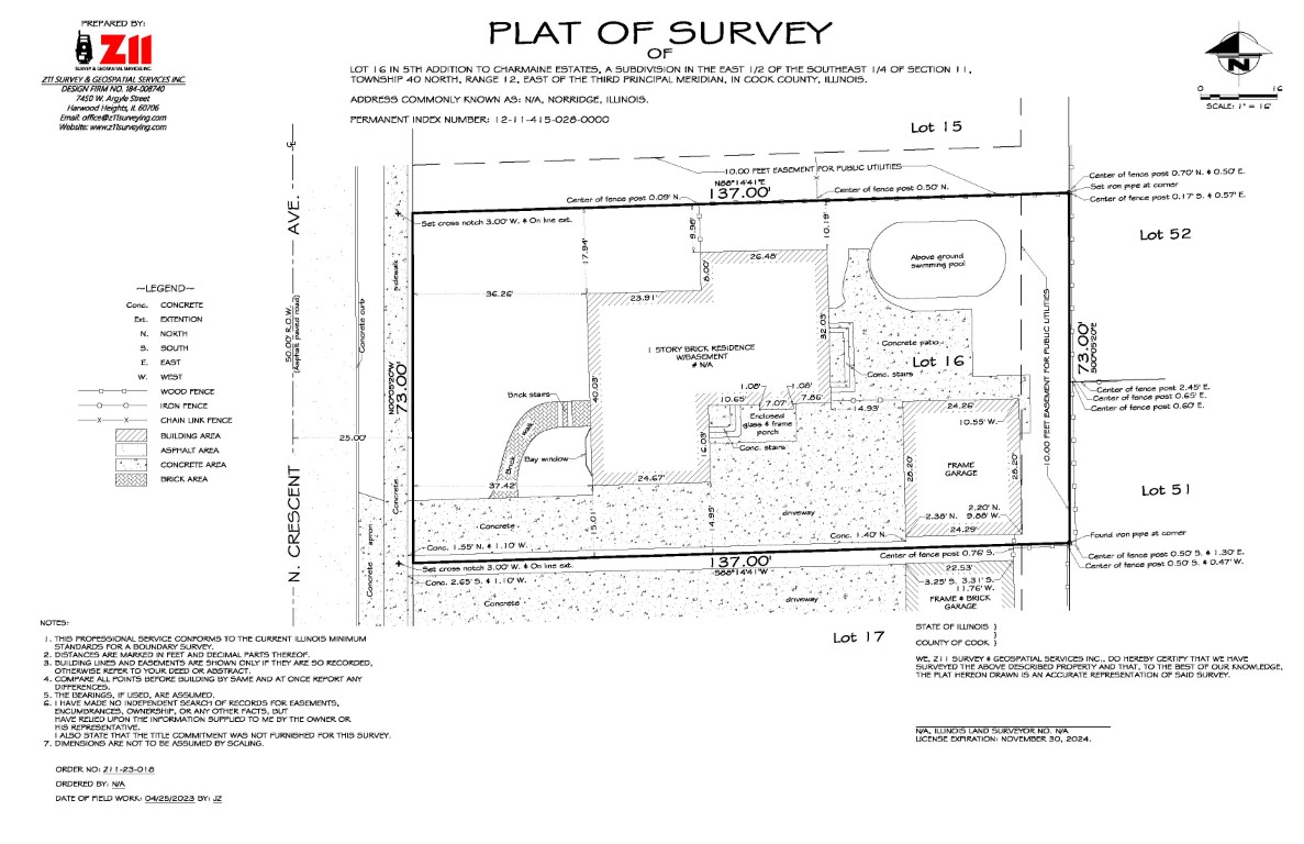
The purpose of a boundary survey is to establish or retrace the boundary lines and corners of the surveyed property, and to define and identify those lines so as to uniquely locate each lot, parcel or other specific land area in relation to well recognized and established points of reference, adjoining properties, and rights of way. Whether it is residential or commercial property, whether you are buying or selling, or adding to your existing house, building a new garage, fence, patio, driveway, or if you are experiencing encroachment issues, you will need a boundary survey. We will perform field survey, which will include locating or resetting property corners according to your deed. All improvements on the property will be located and in case of the presence of any encroachment onto or from the subject property, such encroachment will be shown on the plat. As a final product, we will prepare PDF copies with detailed and easy to read Plat of Survey. This type of survey will comply with the Minimum Standards for Boundary Survey for the State of Illinois.
Condominium survey is specialized class of boundary survey of new construction or conversion of an apartment building with leased apartments into condominiums with private unit ownership. Survey is governed by the Condominium Property Act 765 ILCS 605. It identifies exterior boundaries, individual condominium units, as well as parking spaces.
A Plat of Subdivision allows for the division of large parcel of land into smaller parcels of land known as lots. We perform Subdivision Survey to meet the guidelines of local agencies (village, town, city, etc.) within the boundaries that the parcel is located.
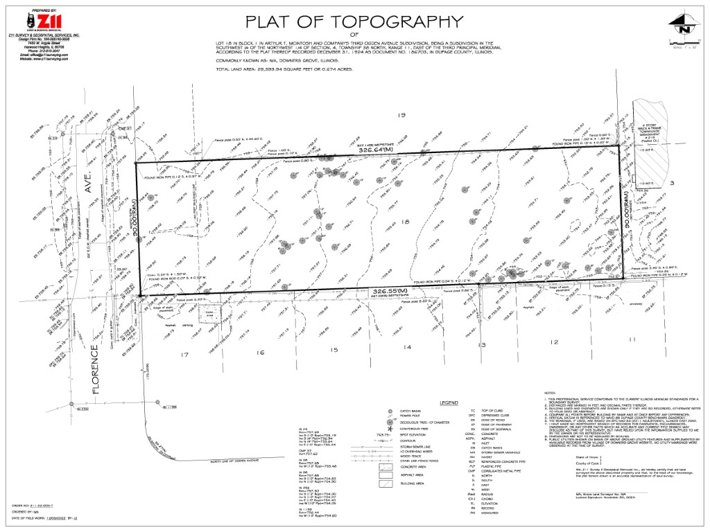
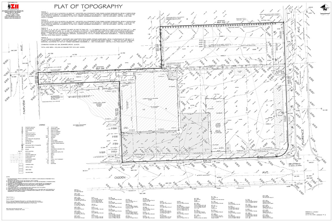
A topographic survey is a delineation of horizontal and/or vertical locations of the existing natural or man-made features of a portion of the earth’s surface, subsurface or airspace and the graphic representation of the results of the delineation. You may need topographic survey for designing a new building or parking area, for drainage plans as well as to establish the limits of a flood zone. Depending on your location, you may need it to meet permitting requirements. We made a high-quality three-dimensional (3D) survey map using accepted Global Positioning Systems (GPS) and Robotic Total Station technologies performed in conjunction with a current Boundary Survey minimum standard requirements.
A telecom survey combines limited features of a boundary, ALTA and topographic survey required for development of new cell tower sites or state of existing.
FAA certification letters provide statement of accurate location, ground elevation, structure and appurtenance elevations for either existing or proposed cell tower sites per FAA filing requirements.